The Indigenous Landscape
“You wouldn’t know it from looking around at the signs for the flour mill and the brewery and the timber felling—you wouldn’t know that this kunanyi has an aboriginal history much longer than the couple of hundred years that white people have been here.”
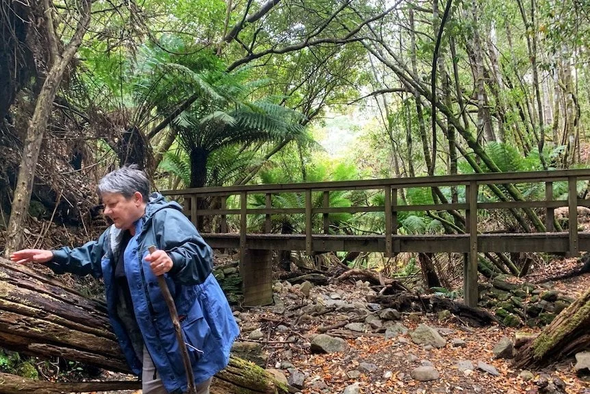
Therese Sainty in mountain country SOURCE ABC NEWS
Hobartians have come a long way from the condescending and offensive image of the 1899 writer ‘E.P.D.’ who in Silver Falls Gully ‘imagined’ a time when ‘probably the dusky aboriginals of this island crouched under their rude gunyahs, and indulged in their barbaric corroborees among the little openings here and there close to the stream’; nevertheless, we are still greatly reliant upon imagination, analogy and guesswork when it comes to the lives of the indigenous people who lived in the shadows of the Mountain for millennia.
All the changes in their community, territory and their developing ideas over tens of thousands of years are unknown and perhaps forever unknowable. Most of what is published is from French or British explorers and the few observant colonists, the invaders. After decades of study, Lyndall Ryan concludes, even our fragmentary knowledge is ‘hazy’.

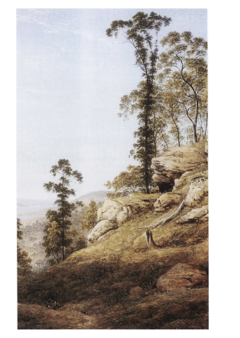
The Mountain was surrounded by the Tahuni lingah—the South East Tribe—perhaps 1000 people—who shared the same landscape, language and love life, but who lived in one of perhaps seven bands. We know at the foot of the mountain, on the coast side, lived the Muwinina band, the responsibility for the eastern face of the mountain was primarily theirs. In the north and west gathered the Melukerdee. Out over the back of the mountain was a different mob. The other two more distant bands were based on Bruny Island and at Recherché Bay. About three hundred people living in the shadows of the mountain they named Kunanyi.
Between them, they spoke the mountain’s name at least three ways. On the eastern flanks ‘Pooranetere’ (also spelt POORANTTERE) while, on the west side, ‘Unghanyahletta’ (otherwise spelled Unghanyaletta). But there is good reason for adopting the third placename: kunanyi.

SOUTH EAST TRIBAL LANDS The land around and including the mountain was the territory of the South East Tribe, whose country ranged from Storm Bay and the D’Entrecasteaux Channel (including Bruny Island) to South Cape, New Norfolk and the Huon Valley.
The seven bands of the Tahuni lingah intermarried and fought together as a nation, but spent most of their time in smaller hearth groups, sleeping in bark shelters, growing up around family campfires, travelling seasonally. The Muhinninas were one of the least migratory groups, but they possessed a stretch of coastline over 500 kilometres in length with bays and rocky capes richly clustered with shellfish and they feasted on their bounty over winter, they crossed to Bruny Island on rafts, they walked the South Coast Track for familial obligations with the North West Tribe. They moved over their 3 000 square kilometre by the paths they trod and on the rafts they built. Sensibly, they walked around the mountain—as they would have walked around lakes and impenetrable thickets, so the top of the mountain was the backcountry for them, but saddles offer quicker access to distant parts north and west and they crossed over. The two most useful, likely paths are what is now Jefferies Track and the Lenah Valley Track. Likely in summer, they climbed the Mountain, camped in its caves and for adventure scaled parts of the Organ Pipes.
“I think it is important for climbers to see cliffs and mountains within a broader framework and to realise that these outcrops—these ‘bones of the planet’—are already sacred.”
The Muwinnina would have sought the mountainsides’ fattest does, its hardest, sharpest stones, its clearest waters, its strongest spearwood, its sweetest nectars. The Tasmanian historian Bonwick noted ‘the wax clusters of Mt. Wellington’ among the fruits and berries consumed. They may also have harvested up there mountain lilies. Certainly, they practiced fire-stick farming in the foothills and all over the back of the Mountain.
“The Aborigines who trod these lands before me had a name for the sound tree trunks make when they rub together the breeze, retakunna. There is no word for it in the English language.”
The Mountain was the coolest place on the hottest days, its Springs never ran dry and its dampest rainforests never caught alight. It is highly likely therefore, in the case of a catastrophic fire, that they would have retreated to its wettest gullies, for these refugia could not burn. In more ancient times, the Mountain’s sides never fully froze like the other glaciated peaks. AT each of its climes, Rodney Dillon says, were different medicines.

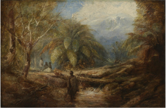
Valley of Ferns, Hobart, Tasmania by John Skinner Prout [c1855]
The mountain—the entire range—was also a fine viewing place, and Robinson was informed by Wooreddy that the people went up the mountain to watch from a safe distance the whites come ashore, then quickly descended paths in several directions to inform the surrounding bands of the news.
They had a campsite above the Springs, where there are a number of caves. They left tool material scattered about in several places nearby and in Lenah Valley. The largest known settlement was mid slope on the Goat Hills—Freycinet came upon it accidentally. A cursory investigation at the summit in the 1990s failed to find any evidence of occupation or any resource material known to be important to Aboriginal peoples, however aboriginal cultural heritage experts are confident that the records of aboriginal occupation are up there to be found.
What place did the Mountain have in their thinking? How did they view it? Aboriginal Heritage Tasmania Chairman Rodney Dillon: "It’s got a significance in the change of its shape, whether it’s snowing or blowing, or whether it’s raining or really hot. The shape of it, the face of it, the way the clouds hang around it, when the mountain changes colour, by the colour of the mountain you can tell what the weather is doing.”
What for a place that is the highest in all your country, which is in sight from almost everywhere and from up upon you can see everything, which silhouettes itself, and behind it sink the fires of the night: what for a place not just ever-present but all-powerful. You make it sacred. What is the Mountain’s cosmology? Laller made the Mountain. Perhaps the southern tribes feared the Mountain. “Thunder and lightning [parperdy] came from the Big Hill”, Therese Sainty told us. Rodney Dylan tells that the source. Two caves. In another telling, out behind the Mountain is the creator ancestor Culla~Minna, set as stone. And after you die?
“I have always been taught that the mountain system that you connect with the most is the place where your spirit will go when it’s time to leave and to enter to the spirit world. For that reason, I don’t often walk on the mountain, knowing that that’s where I’ll go when I need to.”
Thus for hundreds of generations until the investigators arrived and soon afterward came the invasion.
From the sea, the French explorer Baudin witnessed smoke from fires all along the southern rangers. It appears highly likely that this burning occurred on the Mountain, almost to the Pinnacle. Freycinet confirmed this when he spent a day following the Muwinina across the back of the mountain, starting fires all the way they went.
Matthew Flinders in 1801 noted in his Observations on the coast of Van Diemen’s Land that ‘From appearances it seems that the south-east part of Van Diemen's Land is tolerably well inhabited.’ Rowing to shore he made several attempts to meet the Muwinina, but “Once only, in the upper part of the river, were we able to overcome their efforts to avoid us. Two women ran off screaming, but a man stayd to receive Mr. Bass and myself. He was a short, slight made man, of the middle age. His countenance was more expressive of benignity and intelligence … and his hair was either cut or burnt very close. Our firearms were neither objects of curiosity or alarm and the only part of our dress that attracted his attention were the red handkerchiefs about our necks. He understood none of the dialects spoken in the neighbourhood Port Jackson or the common words of the Otaheitean language. He carried two small spears in his hand but seemed to be devoid of fear. He accepted a swan that was presented to him with great joy.”
In this one interaction is all we need to know. The parallels are striking. The people of long ago were like us joyful and lived and likely thought like us, explored the mountain, exploited it, had different names for it, drank of its waters, ate of its riches, admired it as we do—for unlike the coastal plains today, the Mountain’s slopes and high echelons remain much as they have stood for millenia.
The Muwinina are today lost, but the nearest descendants, the palawa/pakana, in their stead, hold themselves responsible for the mountain, and starting from the position that the mountain rightfully belongs to them, that its title was never ceded, and that they now seek re-empowerment through it:
“Tasmanian Aborigines desire re-empowerment in land management … to continue relationships with land that has not been despoiled – much of which is in national parks.”
Aboriginal guides now lead people on cultural tours of their Mountain. Artists have painted it.
In 2026, plotting the future of the Mountain, the state government’s Our Mountain’s Future strategic review (and the community survey that informed it) has many many references to the significance of the Mountain to the Palawa, and proposes actions to protect and celebrate those values. An Aboriginal person will be appointed to the Mountain’s new management board. Special protection can be given to its most significant features, which includes the Octopus Tree.
HERITAGE VALUES
Muwinnina Country exhibits aesthetic, social and spiritual values.
HERITAGE SIGNIFICANCE
The National Heritage Commission investigation into the nomination of Wellington Park concluded in 2002 that yes, the Park did contain national heritage significance, and part of that was based on the possibility of “the existence of Indigenous cultural values of national estate significance in this place.”
This is all highly significant to Aboriginal Peoples as well as to others, and the Park’s management plan makes this clear. Aboriginal culture is, of course, more than sites, more than stones and bones: it is also about the journey, beliefs and practices. Its cultural significance exists in the past, the present and the future.
For more than a decade, palawa leaders have reiterated their view that the Mountain is very significant and has very high cultural significance. Their voice has been heard.
HERITAGE ASSESSMENT
In 2026, plotting the future of the Mountain, the state government Action Plan (and the community survey that informed it) has many many references to the significance of the Mountain to the Palawa, and proposes actions to protect and celebrate those values.
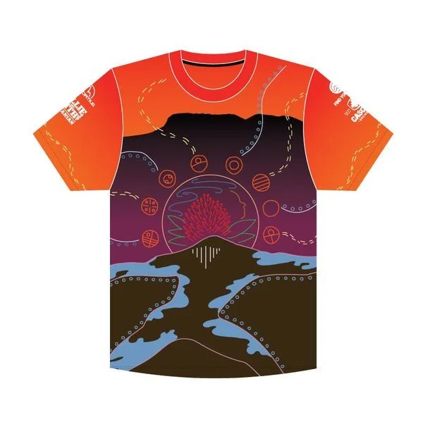
Designed by Sharnie Read and Jye Crosswell, this 2022 running shirt shows the beginning of the palawa and Time itself. It shows the bringing of water and fire. The sun and moon, withi and punapiri, the givers of all life, rise above kunyani. Important plants and animal tracks also wind across the design. The mountain is seen from two viewpoints to highlight its many aspects and beauty from every angle.